|
More Sinkholes and Tino's Cave
The plan for the second day was to drive the vehicle as far as possible on an old logging road, approximately 3 kilometers from camp, then head into the jungle in search of point 14. We also planned to check out an area beyond point 14 that looked promising from the Star3i data, although we had not pinpointed any specific sinkhole features there. Time permitting, we hoped to visit an unexplored cave that William had seen before called Tino's Cave.
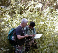
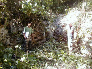
We managed to get the vehicle through the black mud of an old milpa area (farmland) and once again headed off into the thick jungle with our trusty map and GPS unit. In about an hour, we came upon point 14, which turned out to be another semicircular depression cut into the limestone bedrock. Again we had found what for all intents and purposes was a sinkhole feature, yet it did not go deep into the earth.
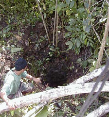
We proceeded up a small incline through jungle so thick it made the undergrowth we had been chopping the previous day seem like an open field. We knew we had to skirt around a mountainside and then drop into another valley to reach Tino's Cave. On our way we discovered a very small sinkhole hidden in the thick underbrush. We cleared the entrance and noticed that it appeared to go down about 10 meters. Bruce suited up and rappelled into the sinkhole to check it out. It went down about 13 meters and opened up into a small chamber approximately 5 meters in diameter. The chamber was filled with silty dirt and leaves, and there was no evidence of an ancient Maya presence inside. We marked the sinkhole location with the GPS in hopes that it would be useful in refining future remote-sensing techniques.
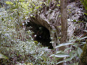
After Bruce climbed out of the small sinkhole, we hiked another kilometer and a half through the extremely thick bush. We came upon Tino's Cave and marked it on the GPS and the map. The entrance of the cave was a low crawl approximately 7 meters wide, 2 meters high at the dripline, and 1 meter high going into the mountainside. There were a few potsherds in the entrance of the cave, as well as rocks and debris that indicated that the entrance may have been walled up by the ancient Maya. We donned our helmets and lights and went inside.
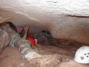
We encountered and killed a few assassin beetles just inside the entrance and headed down a small passage for about 25 meters. We came to a small chamber that had evidence of burning episodes by the Maya. Above this chamber there was a low passage that continued further in. We climbed up to the shelf and crawled like inchworms through the passage for about 10 meters until we reached a very low, thin passage. We were unable to make it through the opening, but we could see that beyond it the cave opened up to a large chamber.
It is possible that this opening was larger during the time of the ancient Maya and became constricted over time because of dripwater activity and calcium carbonate deposition. Future investigations in Tino's Cave are needed in order to explore this possibility. We exited the cave, hiked back to the truck, and headed back to camp for much needed food and relaxation.
|