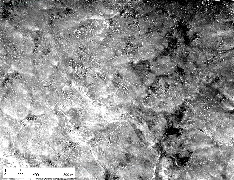
PHILADELPHIA, PENNSYLVANIA—According to a Science Magazine report, anthropologist Emily Hammer of the University of Pennsylvania and her colleague Jason Ur of Harvard University have created an index of several thousand high-resolution photographs taken with sophisticated cameras suspended from U-2 spy planes that flew reconnaissance missions throughout the Middle East during the 1950s and 1960s. These images, declassified in 1997, offer a more detailed look at the surface of the ground than do modern images on Google Earth. However, archaeologists have not previously used the images for research purposes because they have not been digitized, have been hard to access, and information about where the photographs were taken has remained classified. Hammer and Ur employed their knowledge of the Middle East and geographic clues in the photographs to reconstruct possible flight paths of 11 of the formerly top secret missions. The researchers also identified three known sites in the U-2 photographs: Iraqi marsh villages whose residents were displaced in the 1990s, canals at Nimrud, and prehistoric walled hunting traps known as “desert kites” in eastern Jordan. For more on the use of aerial imagery in archaeology, go to “Satellites on the Silk Road.”