Water
Water Power
By JARRETT A. LOBELL
Friday, February 10, 2023
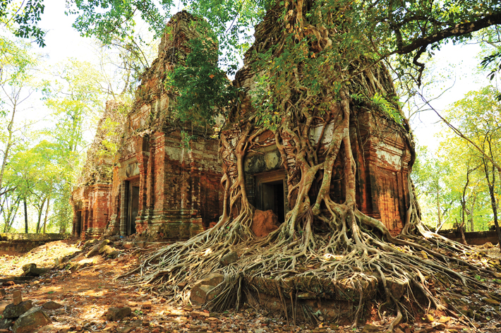 Although relatively short, the tenure of Jayavarman IV (reigned A.D. 928–941) as king of ancient Cambodia’s Khmer Empire (ninth to fifteenth century A.D.) was nonetheless eventful. One of the king’s key decisions was that henceforth the empire’s capital would be Koh Ker, 75 miles northeast of the previous—and future—capital at Angkor. In addition to nearly 80 temples, numerous palaces, an enormous pyramid, and miles of roads, Jayavarman IV built the largest reservoir in the empire’s history to burnish his reputation. While these highly ambitious works—which rivaled later projects at Angkor—might have secured Koh Ker’s place as the capital in perpetuity, researchers now believe that the reservoir’s failure may have been a cause of the capital’s downfall.
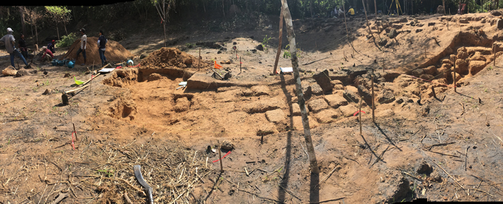
An international team has recently mapped a spillway and a 750-foot-long, 131-foot-wide, 13-foot-high chute created to discharge excess water from Koh Ker’s main reservoir. Managing runoff was especially important considering Cambodia’s monsoon climate and the area’s rolling topography. But the chute’s capacity was not sufficient to prevent water from overtopping one section of the reservoir’s embankment, which was then severely eroded by fast-flowing water. “The reservoir’s outlets were poorly designed and the spillway’s capacity for draining excess water from the reservoir was inadequate,” says engineer Terry Lustig, who collaborated with the project. “We think that it’s even possible that the system failed during the first rainy season after it was constructed.” This may have had important political implications. “Embarking on projects of civil engineering was central to establishing the legitimacy of some Khmer kings, and I am inclined to believe that the main purpose of the reservoir was to be a monument the king built for himself,” says Lustig. “It’s therefore not difficult to envisage that the failure of the water management system at Koh Ker may have had a significant impact on the prestige of the sovereign and contributed to the decision to reestablish Angkor as the empire’s capital.”
The Limits of the Nile
By JASON URBANUS
Friday, February 10, 2023
 The Nile was the lifeblood of ancient Egypt, and its inundation was the pivotal annual event in Egyptian civilization. Every summer, between May and September, the river gradually swelled until it overflowed its banks and flooded the surrounding plains. When the waters receded, they left behind layers of fertile deposits that were essential for growing crops to feed the realm. However, the floodwaters fluctuated from year to year, and when they fell short of or surpassed the optimal level, dire consequences followed. An insufficient flood meant that the water did not reach all arable land, often resulting in famine and civil unrest. On the other hand, overflooding could destroy infrastructure, wipe out livestock, and breed pestilence and disease.
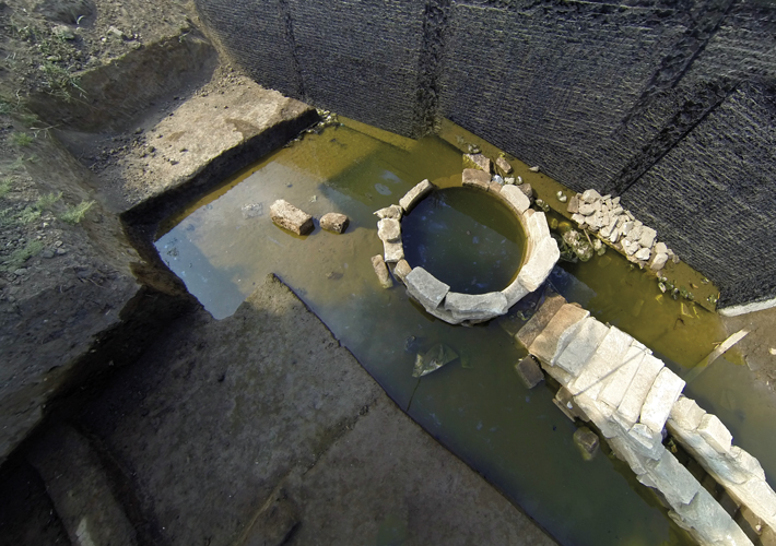
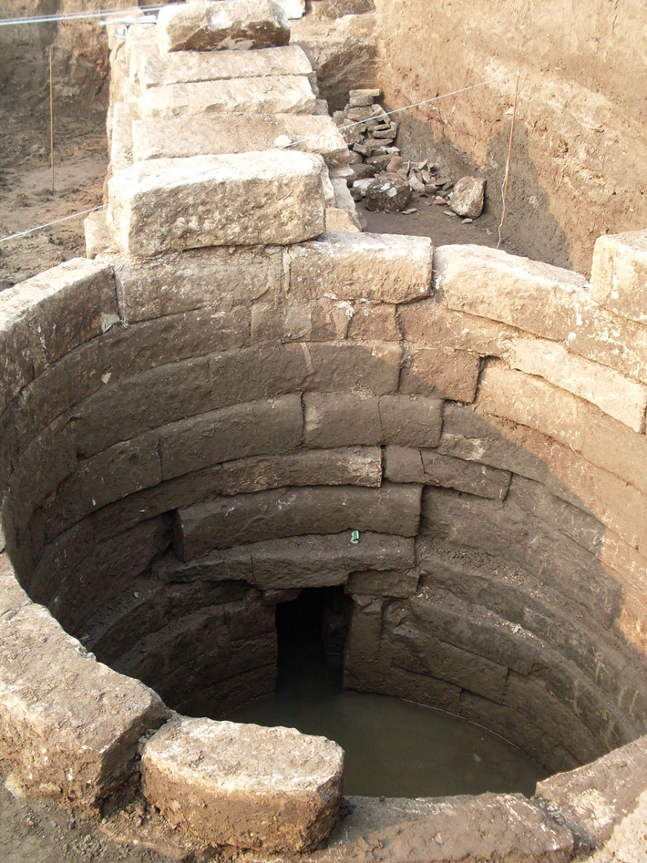 To gauge and help forecast each year’s flood, Egyptians developed a device known as a nilometer. “Nilometers evolved as a sacred means of monitoring, communicating, and experiencing variations in the behavior of the river,” says Nottingham Trent University archaeologist Jay Silverstein. Nilometers were once located up and down the Nile, and while archaeological evidence of the earliest devices is scarce, inscriptions mentioning nilometers date back 5,000 years. The most recently discovered example was found in the Nile Delta at the Greco-Roman city of Thmuis, modern-day Tell Timai, and was constructed in the third century B.C.
Nilometers were built in a variety of shapes and styles and were located next to the river or linked to it through channels or conduits. The main feature of most nilometers, including the one at Thmuis, was a holding tank or well that was fed by the Nile’s waters. As the river rose and fell, so did the water level within the nilometer. Some nilometer complexes housed a staircase that provided easy access for those charged with measuring the water. Others included a column with evenly spaced marks that acted like a giant ruler indicating the river’s height. During the flood season, priests monitored water levels daily to help predict how the flood was progressing. “As the Nile approached its optimal level,” Silverstein says, “the priests would watch carefully and, when it achieved that point, there would be great festivities and floodgates to fields would be opened.”
Saving for the Season
By BENJAMIN LEONARD
Friday, February 10, 2023
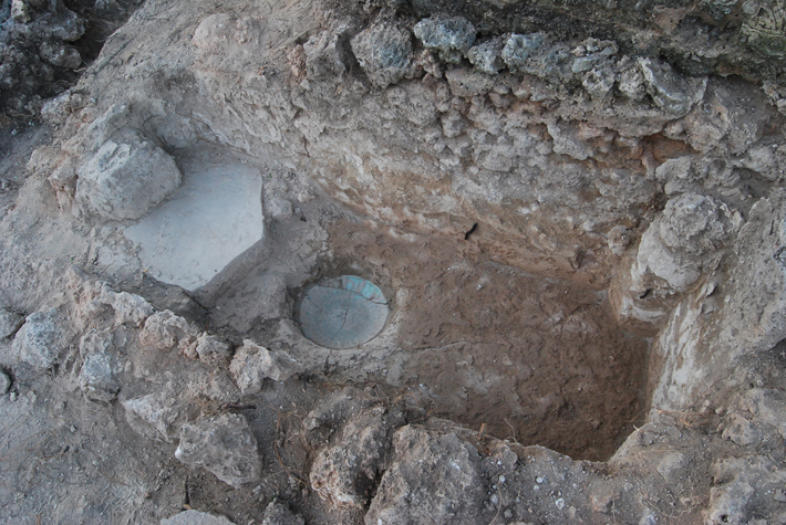 Storing water was essential to the livelihood of the Swahili people, who flourished along the coast of East Africa from the seventh to sixteenth century A.D. Many still live there today. In the past, they engaged in lucrative trade as far away as China. In the towns they called home, however, the Swahili grappled with an arid climate and water scarcity, enduring a nine-month-long dry season with little to no rain. “All these towns are in slightly different environments, but they’re all in places where access to fresh water is marginal,” says archaeologist Stephanie Wynne-Jones of the University of York. In addition to being used for drinking, cooking, and washing, fresh water was necessary for ritual ablutions required before entering the towns’ mosques and for making the lime plaster the Swahili used to construct their coral houses. At Kilwa Kisiwani and Songo Mnara, two settlements on neighboring islands in the Kilwa Archipelago off the coast of southern Tanzania that Wynne-Jones has excavated, the Swahili devised different ways of collecting and storing fresh water.
During an age of prosperity that began in the late fourteenth century, Kilwa Kisiwani grew to encompass a population of several thousand, and some of its residents are thought to have founded a new settlement at Songo Mnara. Many communal wells, which, says Wynne-Jones, were vital hubs of urban life, supplied the people of Kilwa Kisiwani with fresh water. Songo Mnara’s groundwater, however, was more brackish. There were wells in the town center and at each of its six mosques, but for daily use, residents seem to have relied more on storing water. “There are cisterns in every house at Songo Mnara to capture and store rainwater,” Wynne-Jones says. “We don’t see that to the same extent at Kilwa.”
The Swahili put a great deal of effort into creating and beautifying spaces for washing. On either side of the steps of Songo Mnara’s central mosque, a pair of cisterns is connected by a conduit in which imported Chinese celadon bowls and plates, signs of prestige and wealth, were mortared into the bottom. Some scholars suggest the ceramics helped assess the water’s purity. “Looking at this green plate through the water,” Wynne-Jones says, “you could see if the water was discolored.”
Advertisement
Advertisement
IN THIS ISSUE
Advertisement

Recent Issues
-
 May/June 2024
-
 March/April 2024
-
 January/February 2024
-
 November/December 2023
-
 September/October 2023
-
 July/August 2023
-
 May/June 2023
-
 March/April 2023
-
 January/February 2023
-
 November/December 2022
-
 September/October 2022
-
 July/August 2022
-
 May/June 2022
-
 March/April 2022
-
 January/February 2022
-
 November/December 2021
-
 September/October 2021
-
 July/August 2021
-
 May/June 2021
-
 March/April 2021
-
 January/February 2021
-
 November/December 2020
-
 September/October 2020
-
 July/August 2020
-
 May/June 2020
-
 March/April 2020
-
 January/February 2020
-
 November/December 2019
-
 September/October 2019
-
 July/August 2019
-
 May/June 2019
-
 March/April 2019
-
 January/February 2019
-
 November/December 2018
-
 September/October 2018
-
 July/August 2018
-
 May/June 2018
-
 March/April 2018
-
 January/February 2018
-
 November/December 2017
-
 September/October 2017
-
 July/August 2017
-
 May/June 2017
-
 March/April 2017
-
 January/February 2017
-
 November/December 2016
-
 September/October 2016
-
 July/August 2016
-
 May/June 2016
-
 March/April 2016
-
 January/February 2016
-
 November/December 2015
-
 September/October 2015
-
 July/August 2015
-
 May/June 2015
-
 March/April 2015
-
 January/February 2015
-
 November/December 2014
-
 September/October 2014
-
 July/August 2014
-
 May/June 2014
-
 March/April 2014
-
 January/February 2014
-
 November/December 2013
-
 September/October 2013
-
 July/August 2013
-
 May/June 2013
-
 March/April 2013
-
 January/February 2013
-
 November/December 2012
-
 September/October 2012
-
 July/August 2012
-
 May/June 2012
-
 March/April 2012
-
 January/February 2012
-
 November/December 2011
-
 September/October 2011
-
 July/August 2011
-
 May/June 2011
-
 March/April 2011
-
 January/February 2011
Advertisement


