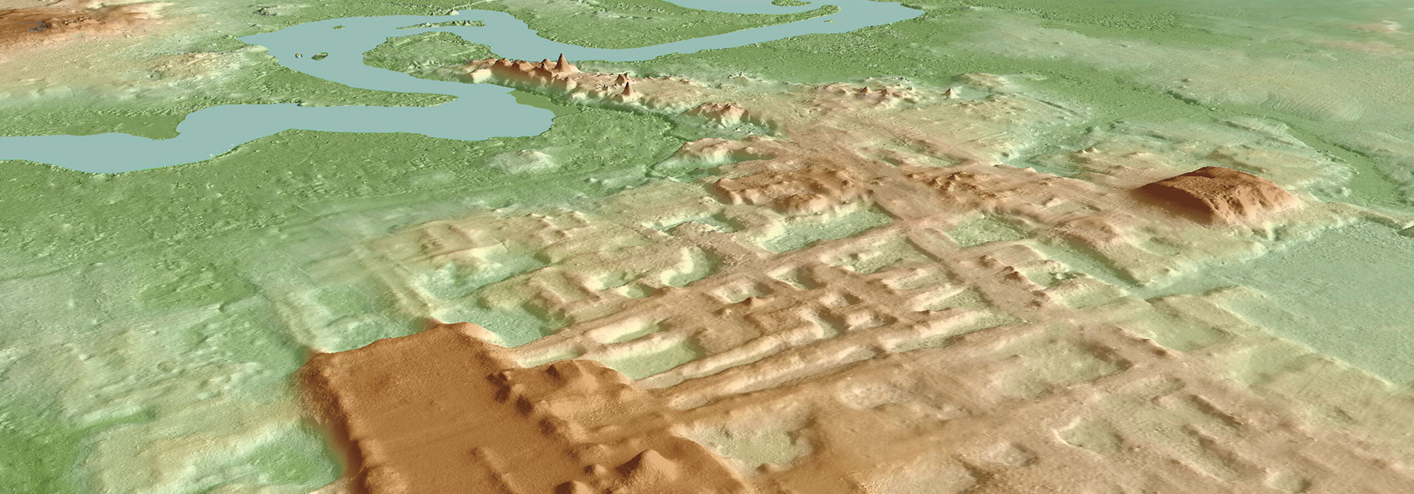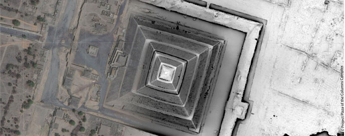
MEXICO CITY, MEXICO—According to a Gizmodo report, aerial scanning technology known as lidar has been used to investigate the eight square miles of landscape once covered by the ancient city of Teotihuacan, which was constructed between 100 B.C. and A.D. 450. Nawa Sugiyama of the University of California, Riverside, said that the city planners conducted large-scale quarrying and excavation projects, including rerouting the San Juan and San Lorenzo rivers to conform to Teotihuacan’s astronomical alignment. Some 65 percent of modern construction in the region is built on the ancient city’s alignments, she added. “These changes made nearly two millennia ago still affect how we construct our buildings, align our roads, and terrace our crops,” Sugiyama concluded. Read the original scholarly article about this research in PLOS ONE. To read about a Mesoamerican trade hub that was once under the influence of Teotihuacan, go to "Off the Grid: Chalcatzingo, Mexico."