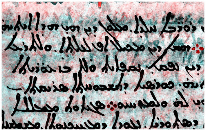
PARIS, FRANCE—Live Science reports that a fragment of a star map assembled by the ancient Greek astronomer Hipparchus has been revealed with multispectral imaging on nine pages of a medieval religious text known as the Codex Climaci Rescriptus, which was originally held at the sixth-century St. Catherine’s Monastery in Egypt’s Sinai Peninsula. “It was immediately clear we had star coordinates,” said Victor Gysembergh of the French National Center for Scientific Research. The numbers state, in degrees, the length and width of the constellation Corona Borealis, and the coordinates for the stars in its farthest corners. The researchers were able to use the coordinates to determine that they were taken in 129 B.C., about the time that Hipparchus lived on the island of Rhodes. Scholars have only known of Hipparchus’s catalog of some 850 stars from references to it in other works. He noted their locations and brightness, and recognized a shift of about two degrees in the position of distant stars from their original positions. He correctly concluded that this shift was due to the Earth’s wobbling on its axis. These newly identified pages have been dated to the fifth or sixth century B.C. based upon the style of the writing. Read the original scholarly article about this research in Journal for the History of Astronomy. To read about a nearly 4,000-year-old star map uncovered in Germany, go to "Mapping the Past: The Nebra Sky Disc."