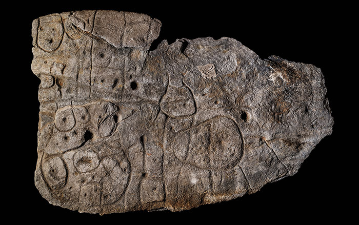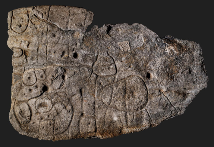
BRITTANY, FRANCE—According to a BBC News report, the Saint-Bélec Slab, an engraved stone measuring about five feet by 6.5 feet, has been rediscovered in the cellar of a castle in western France. The stone was unearthed in 1900 by Paul du Chatellier in a cemetery in western Brittany, where it had been reused as a wall in a stone cist in Finistère. Du Chatellier then stored the Bronze Age carving in his home, the Château de Kernuz, where it sat for more than 100 years. Clément Nicolas of Bournemouth University and his colleagues recovered the slab and studied it with high-resolution 3-D surveys and photogrammetry. They found that the shaped surface of the rock, and repeated engraved motifs connected by lines, are likely to reflect an 18-mile stretch of the network of waterways in Finistère’s Odet River valley. The central motif may symbolize an enclosure surrounded by three river springs, Nicolas added. “It was probably a way to affirm the ownership of the territory by a small prince or king at the time,” Nicolas said of the map. “We tend to underestimate the geographical knowledge of past societies. This slab is important as it highlights this cartographical knowledge.” For more on ancient maps, go to "Mapping the Past."