

-
News April 3, 2026
12,900-Year-Old Dice Identified Among Native American Artifacts
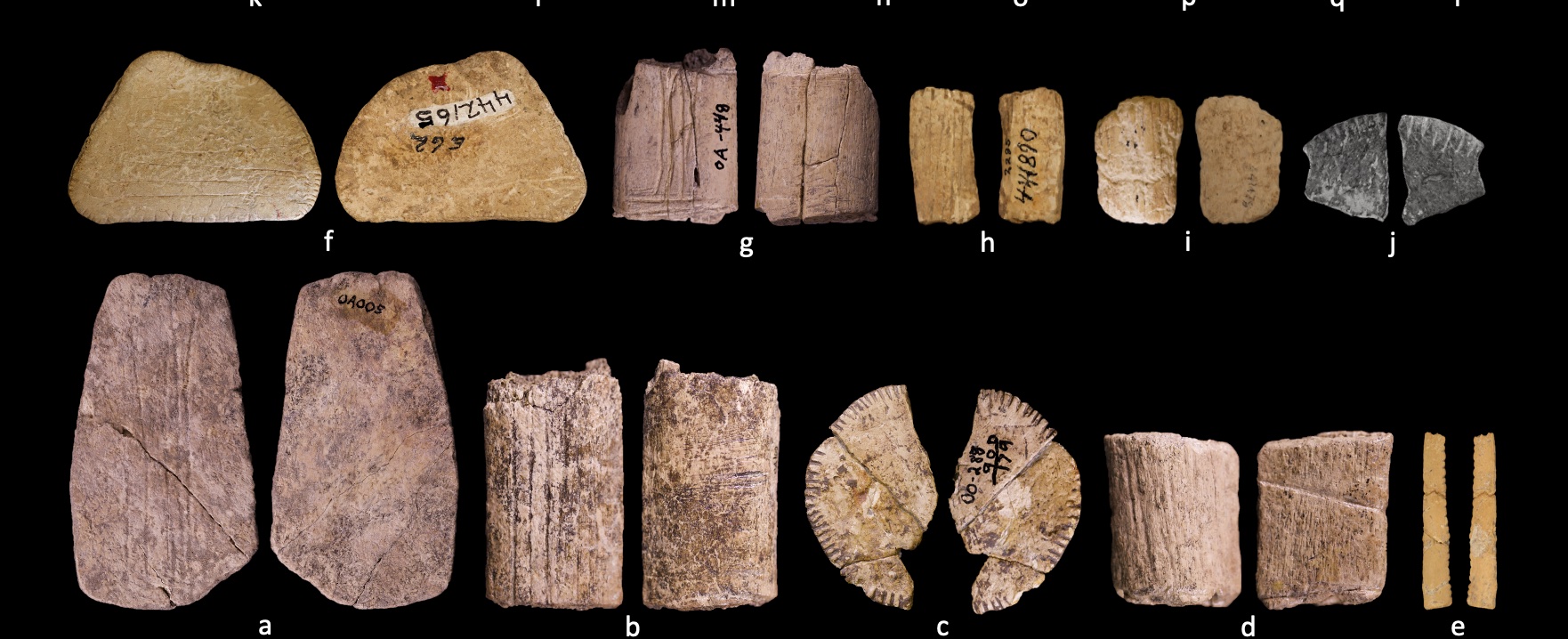 Robert Madden
 -
News April 3, 2026
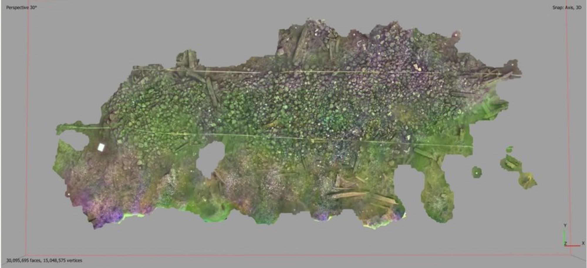
Where Did Bronze Age Mongolians Prepare Their Feasts?
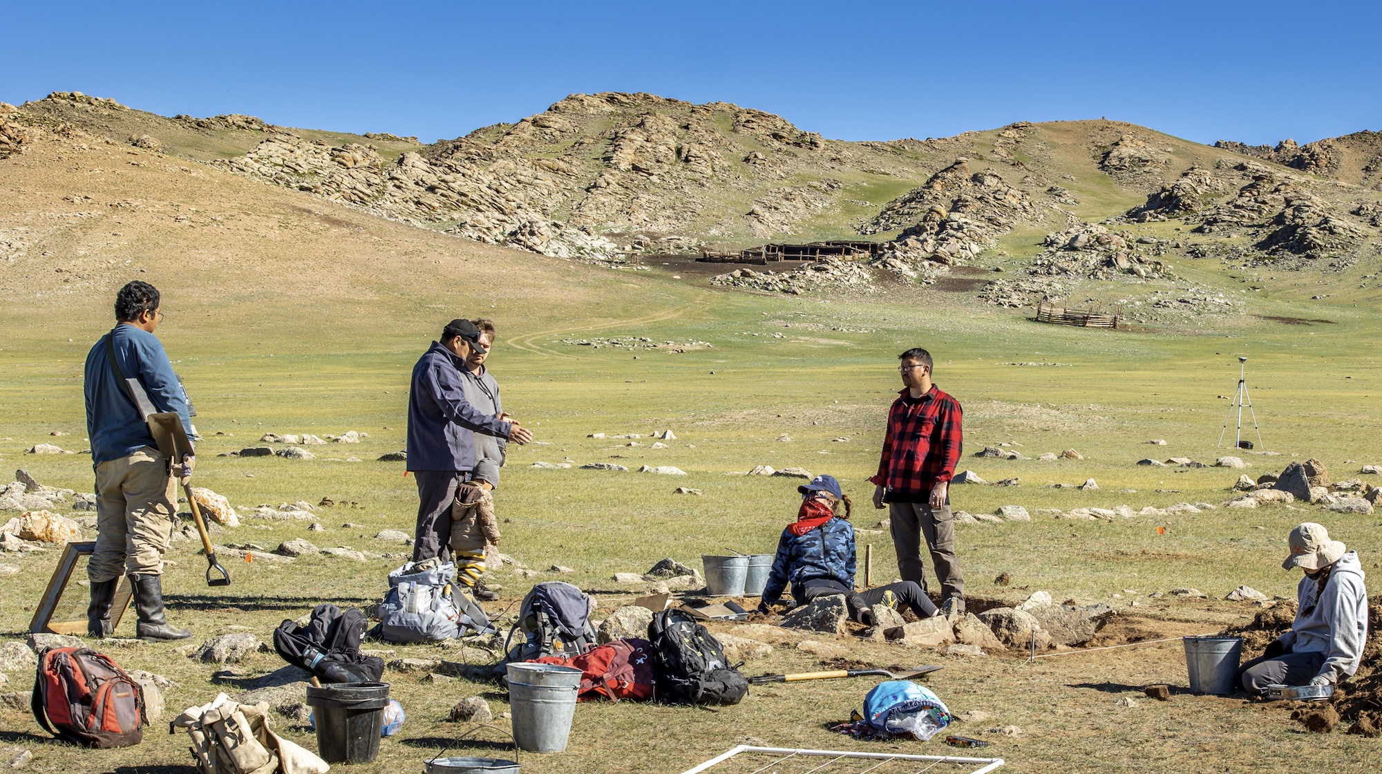 Natalia Égüez
 -
News April 3, 2026
19th-Century Danish Warship Discovered in Copenhagen Harbor
 Viking Ship Museum
 -
News April 2, 2026
Former Occupant of Empty Grave at Florida Fort Identified
 National Parks Service
-
News April 2, 2026
Iron Workshop in Senegal Operated for 800 Years
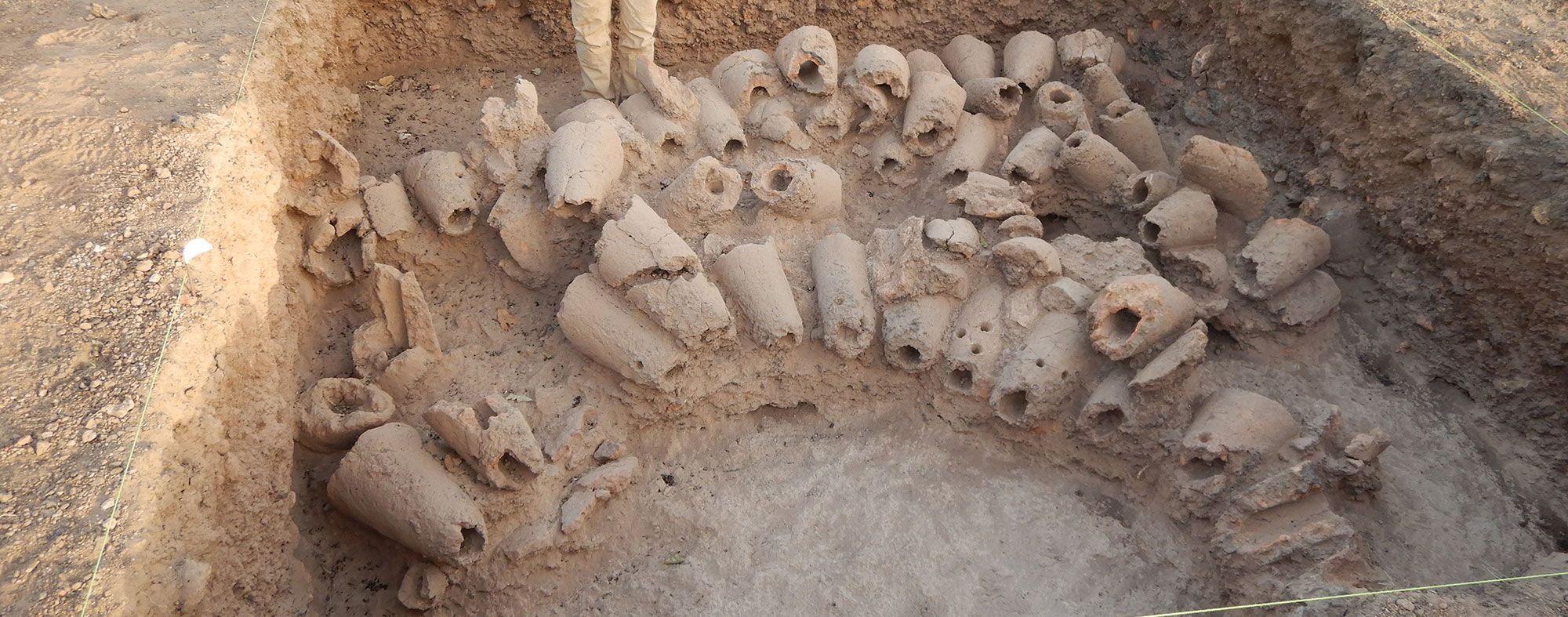 © Anne Mayor
 -
News April 1, 2026
Aegean Underwater Archaeological Sites Surveyed
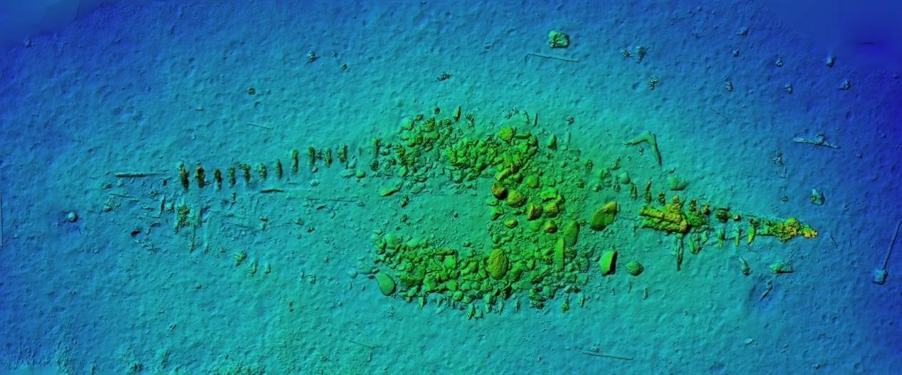 E. Diamantis/Greek Ministry of Culture and Sports
-
News April 1, 2026
Neanderthals from Denisova Cave Were Related

-
News April 1, 2026
Tasmanian Tigers Identified in Northern Australian Rock Art
 Paul S.C. Taçon
-
News April 1, 2026
Shipwrecks Found Near Ancient Port City Off Libyan Coast
-
News March 31, 2026
Artifacts Repatriated to Peru
 Peruvian Ministry of Foreign Affairs
 -
News March 31, 2026
Medieval Populations Mixed on the Mediterranean Island of Ibiza
-
News March 31, 2026
Wine and Frankincense Identified in Roman Incense Burner
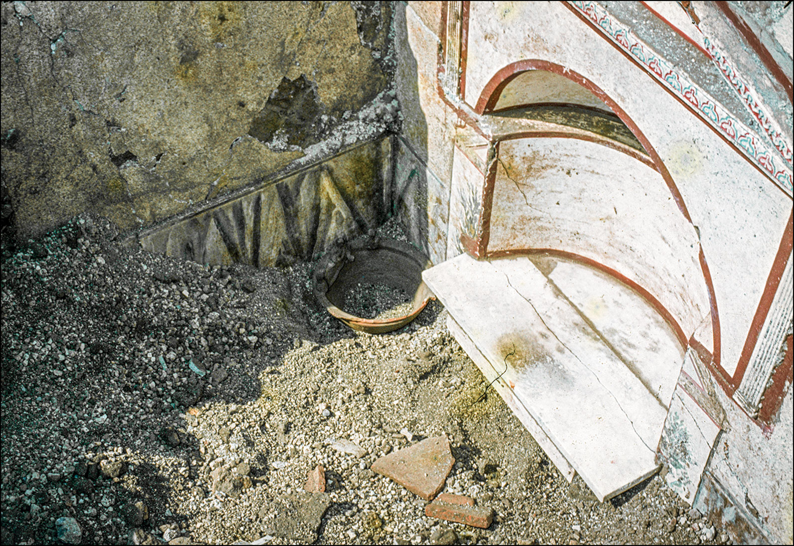 Pompeii, Archivio Fotografico inv. H6803/Courtesy of the Ministero della Cultura – Parco Acheologico di Pompei
 -
News March 31, 2026
New Thoughts on Norwegian Iron Age Mound
 Tommy Gildseth/Wikimedia Commons
 -
News March 30, 2026
Pinot Noir Grape Seed Found in Medieval Pit in France
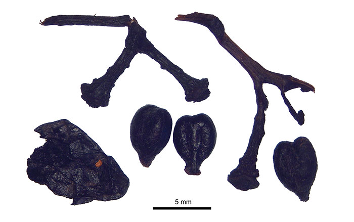 Sarah Ivorra (ISEM, CNRS)
 -
News March 30, 2026
Study Tracks Genetic Lineages of Europe’s Last Neanderthals
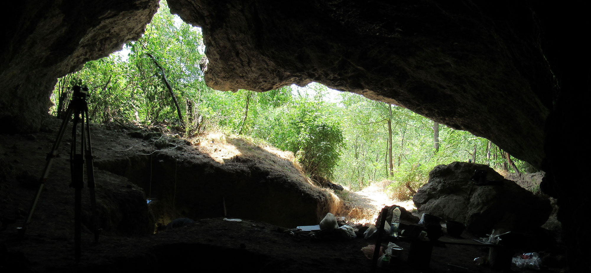 Dusan Mihailovic
 -
News March 30, 2026
Coral Buildings in the South Pacific Dated
 James Flexner, University of Sydney
 -
News March 27, 2026
Rare Illustration of Roman Huntress Identified
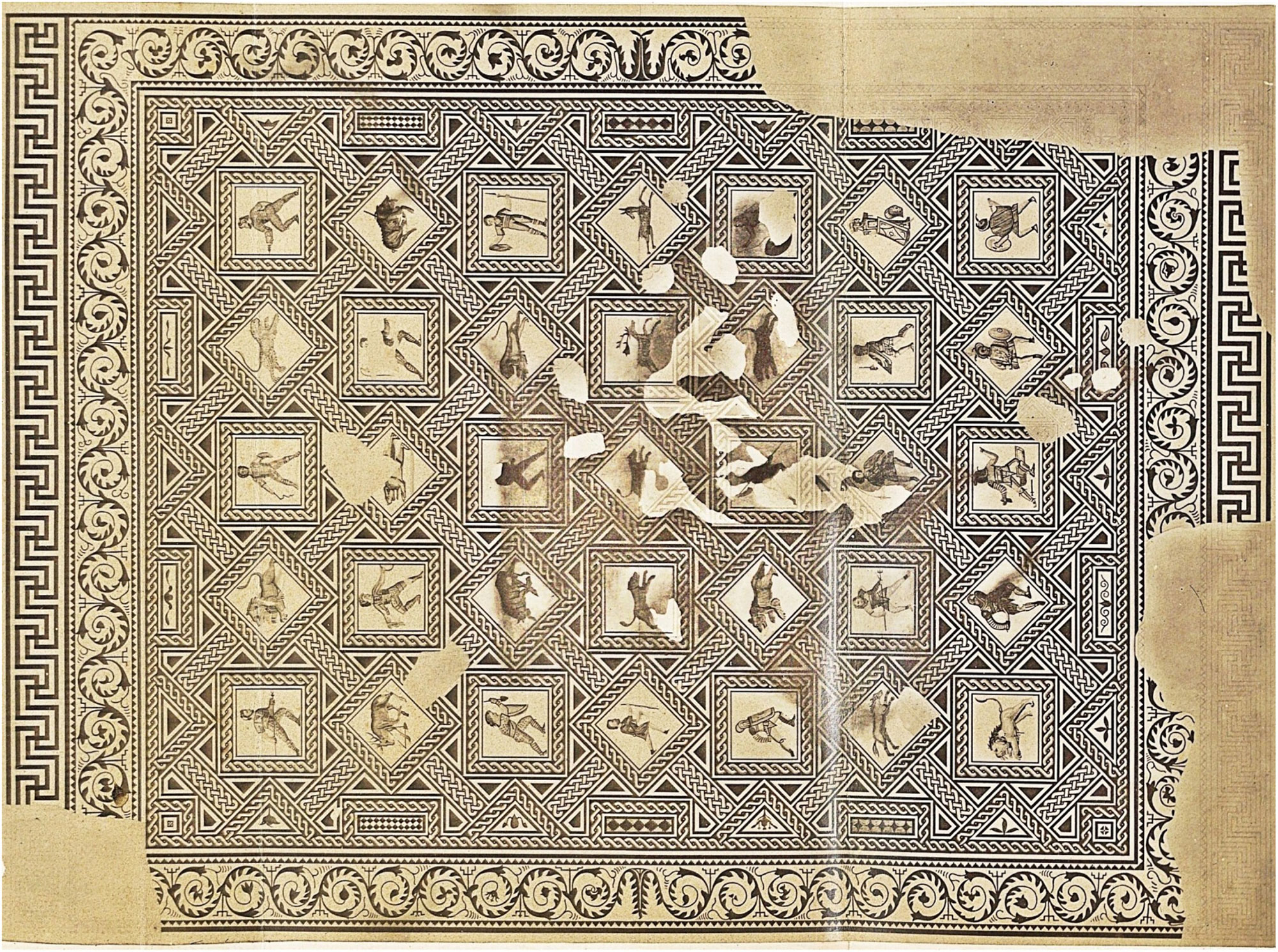 Drawing from Loriquet 1862: planche XVIII/Mañas 2026, Antiquity
 -
News March 27, 2026
Bronze Age Chinese Iron Weapon Fragments Analyzed
-
News March 27, 2026
Dog Domestication in Europe Dated to More Than 14,000 Years Ago
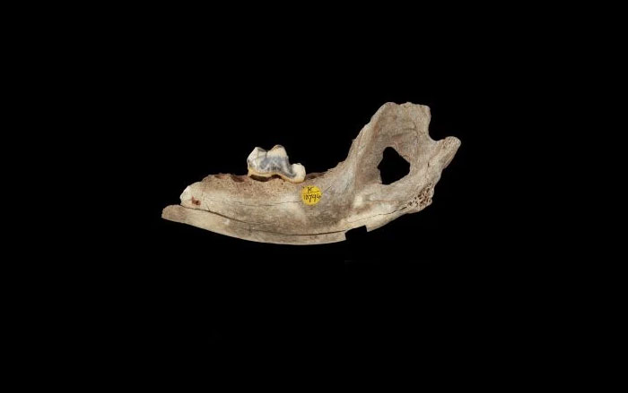 © The Trustees of the Natural History Museum, London
 -
News March 26, 2026
Study Examines Transmission of Syphilis-Like Disease in Ancient Vietnam
 Courtesy Melandri Vlok
Loading...