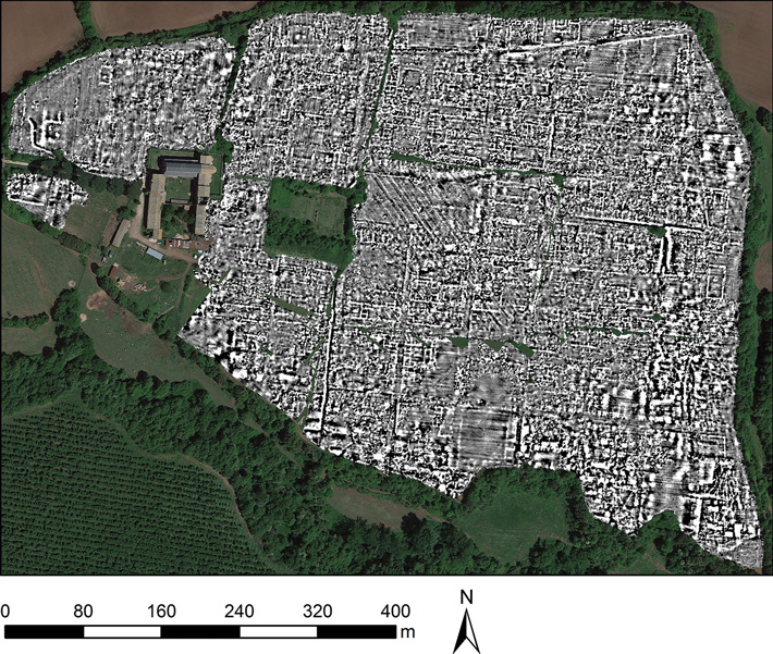
CAMBRIDGE, ENGLAND—Cosmos Magazine reports that researchers from the University of Cambridge and Ghent University mapped the remnants of the ancient city of Falerii Novi with advanced ground-penetrating radar towed behind a quad bicycle. Founded in 241 B.C. and occupied until about A.D. 700, the walled city was located some 30 miles north of Rome and covered about 75 acres. By mapping the site at different depths, the researchers were able to see how the city evolved over time. In particular, the survey revealed a large rectangular building connected to water pipes that ran under city blocks to an aqueduct. This structure is thought to have served as an open-air pool in a public bathing complex. The researchers also detected a possible public monument made up of two large structures facing each other within a porticus duplex, a covered passageway with a central row of columns. Martin Millett of the University of Cambridge and his colleagues noted that the public buildings they detected in Falerii Novi were more elaborate, and the city’s layout was less standardized, than expected, based upon previous studies of other small Roman cities. To read about a Roman fortification outside Trieste that was surveyed using ground-penetrating radar, go to "Rome's Earliest Fort."