Digs & Discoveries
An Undersea Battlefield
By JARRETT A. LOBELL
Tuesday, December 06, 2022
From the war diary of USS Aylwin
Sunday, 1 September, 1918
Proceeding as part of escort of combined convoys O.E.21 and O.L.32 through the Irish Sea. About 1 P.M. near entrance to St. George’s Channel two ships of the convoy, the Mesaba and City of Glasgow, were torpedoed. No trace of submarine nor of the torpedo was seen. Dropped 30 depth charges on probable position of spot and proceeded with convoy. About 6 P.M. at the southern entrance of St. George’s Channel a ship in the convoy, the ACTOR was torpedoed. Dropped a barrage of 48 depth charges on what appeared to be the origin of the wake of the torpedo and near spot where periscope was reported to have been seen. The ACTOR was not badly damaged and was eventually towed into port by tugs sent out from Queenstown. Proceeded with convoy.
By the summer of 1917, during World War I, circumstances in Britain were extremely dire. Since 1914, the lives of 40,860 British merchant seamen, fishermen, and passengers had been lost, and 5,696 ships sunk, most by the dozens of German U-boats patrolling the Atlantic. The threat was grave not just to those crossing the seas, but to Britain itself, which, by many estimates, had only about six weeks of food remaining. “Britain was only ever going to succumb to Germany if the country starved, and the Germans came very close to succeeding,” says archaeologist Innes McCartney of Bangor University. “The merchant marine was being decimated and Britain wasn’t able to produce new ships as quickly as they were going down.” What changed the tide of the war and saved Britain from both starvation and defeat was the introduction of the convoy system, in which ships would travel together in groups. “The convoy system was brought in as a last desperate measure to stop the Germans from sinking merchant ships that were sitting ducks when sailing alone,” says McCartney. Thus, when U-boat crews spotted smoke on the horizon, it was no longer from a lone ship, but from a group of ships protected by the navy. “That changed the game completely,” he says.
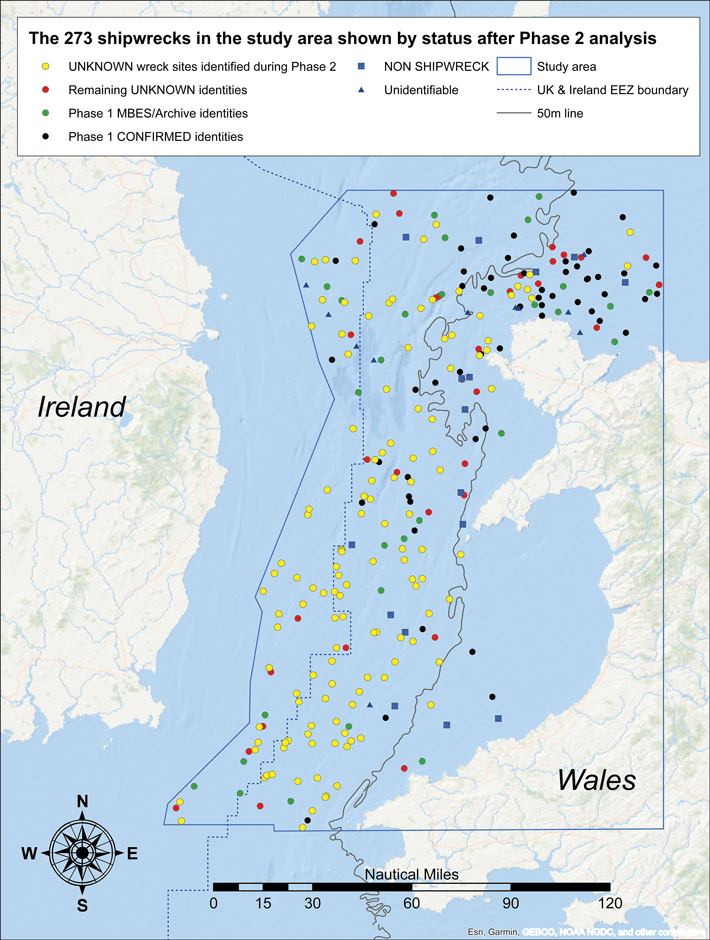 Now, an expansive archaeological survey has revealed new information about hundreds of ships whose stories had been incorrectly or incompletely told. The physical impact of these vessels on the seafloor holds lessons not just for archaeologists and military historians, but for scientists searching for ways to erect the structures needed to produce renewable energy. From 2012 to 2021, marine geoscientist Michael Roberts and a team from Bangor University scanned 7,500 square miles of the Irish Sea floor using multibeam sonar. The team mapped 273 wrecks, including those of trawlers, cargo vessels, submarines, ocean liners, and tankers—some of which, says McCartney, have rare designs or are of national importance, while others are naval graves.
McCartney compared the shipwrecks Roberts’ team had located with the U.K. Hydrographic Office’s database of wrecks. He found that the portion of unidentified or misidentified ships in this area, which was originally thought to be 37 percent, was actually 59 percent. “The first phase of the research was to validate everything that was known about the wrecks, and the second phase was to try to identify the mystery ones,” says McCartney. “The conclusion to be drawn is that we know far less about the names of U.K. shipwrecks than was previously believed. One of the things we can do using this huge data set is correct that.” Eighty percent of the previously unidentified ships in the survey now have their correct names. And, McCartney says, there’s no reason why this same technique couldn’t be brought to bear on all the 9,845 shipwrecks in the seas around the United Kingdom—about 4,000 of which are unidentified—in exactly the same way.
The majority of the 273 ships mapped by Roberts’ team were sunk during the two world wars. For McCartney, the World War I–era ships provide important examples of how to use the survey data. “World War I at sea is primarily a war against U-boats and is the longest battle of the war,” he says. “This study combines landscape archaeology and battlefield archaeology and involves thousands upon thousands of objects.” The survey has allowed McCartney to archaeologically document the success of the convoy system. “Nearly all of the World War I shipwrecks we see were sunk while sailing independently,” he says. “Convoy losses are comparatively rare.”
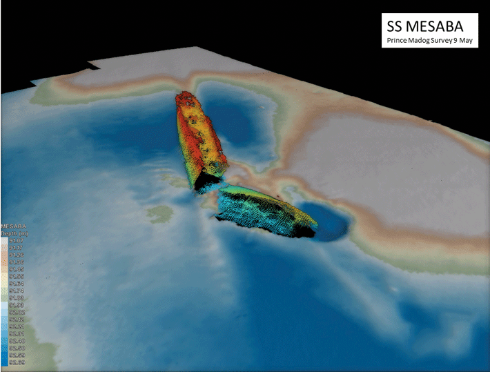
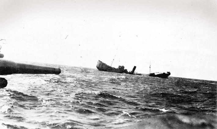 There are, however, two ships identified by the survey that were sunk despite being part of convoys. The merchant steamships SS Mesaba and SS City of Glasgow are both large vessels known to have been sunk on September 1, 1918, by submarine UB 118, killing all on board. Six years before, Mesaba had had a small role in one of history’s most famous shipwrecks. While crossing the Atlantic, the crew of Mesaba radioed a message to RMS Titanic warning her to beware of icebergs. The message never reached Titanic’s bridge.
The survey has also presented the opportunity to correct the historical record with respect to the WWII-era anti-submarine minefields around Britain. “Before my U-boat studies began in 1997, only three U-boats were thought to have been sunk by mines around the U.K. in World War II, but now there are nine,” McCartney says. “Unidentified submarine wrecks are just as important to identify as any other mystery shipwreck. Archaeological survey of these wrecks is, over time, changing the narrative of aspects of the world wars.” And it’s not only archaeologists for whom the data from the survey is critical. Some of the wrecks pose an environmental threat. One of four tankers McCartney identified is known to have been carrying heavy fuel oil, which is used for marine engines. It is much denser than regular oil and contains particularly harmful contaminants, making a spill or leak highly destructive. Other vessels contain unexploded munitions. “It’s important to know where these things are so they can be managed,” McCartney says.
The ships are also providing a huge amount of information to companies searching for stretches of seabed stable enough to support the structures needed to create wind farms. “Ships offer a proxy for how metal structures on the seabed for decades weather and change over time,” says Roberts. “The clock is ticking, because in fifty years those ships might not be there.” According to McCartney, accurate dating of such a large number of wrecks in one area will have a major impact on the study of seabed dynamics, creating better models for the placement of wind farms and tidal generators. And, for archaeologists seeking relatively low-cost, noninvasive ways to explore the landscapes of the past, surveys such as this are invaluable. “Multibeam underwater geophysics is doing for the undersea landscape what aerial photography did for the terrestrial landscape in the 1920s,” says McCartney. “We can see the undersea landscape in a completely different way, and we are at the forefront of a really interesting time.”
Hadrian's Bugler
By BENJAMIN LEONARD
Tuesday, December 06, 2022
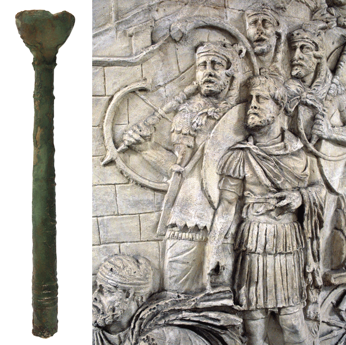 While digging beneath an early third-century A.D. officers’ clubhouse at the site of the Roman fort of Vindolanda in northern England, archaeologists unearthed a rare copper alloy mouthpiece belonging to a cornu, or horn. The mouthpiece lay on the floor of a military workshop that was in use around the time construction began on Hadrian’s Wall. It has been dated based on the context and associated finds on the workshop floor to between A.D. 120 and 128. The fragment was part of a nearly 10-foot-long instrument shaped like the letter G that was used to relay orders to troops during battle. “It was a real surprise to find something so individual and delicate as a musical instrument,” says archaeologist Andrew Birley of the Vindolanda Trust. “You just don’t expect an object as fabulous as this to be sitting on a workshop floor.” Modern replicas of the cornu provide an idea of the sounds Roman soldiers would have heard during skirmishes on the empire’s edge. “I am struck by the incredible range you can get with the instrument,” Birley says. “It can be loud and brash, but also delicate and soulful.”
To hear musician Letty Stott play a replica cornu at Vindolanda, see the video below.
(Un)following the Recipe
By DANIEL WEISS
Tuesday, December 06, 2022
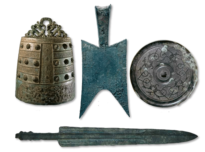 The Rites of Zhou, an administrative text dating to late in China’s Eastern Zhou Dynasty (771–256 B.C.), includes six recipes for creating bronze objects such as bells, mirrors, and swords based on the combination of two ingredients: Jin and Xi. Some scholars have assumed that Jin was copper and Xi was tin, but if this were the case, the recipes would have produced metal with far higher tin concentrations than has been detected in Eastern Zhou bronze items. Moreover, these bronze artifacts generally contain at least 10 percent lead. While lead can be a contaminant in copper, this would not account for the levels of lead that have been measured.
Ruiliang Liu, early China collection curator at the British Museum, and archaeologist A. M. Pollard of the University of Oxford propose that Jin and Xi were actually alloys. The recipes could work, they calculate, if Jin were roughly 80 percent copper, 15 percent tin, and 5 percent lead, and if Xi were equal parts copper and lead. This could mean that Jin and Xi were mixed before being delivered to workshops where bronze objects were produced. However, given the wide variability in the proportions of metals in Chinese bronze items from the time, it seems that the recipes in the Rites of Zhou conveyed an illusion of uniformity lacking in practice. “The alloying composition is all over the place, which means that the people in the workshops were never following these recipes very strictly,” says Liu. “They were doing whatever they liked, and the archaeological materials show that.”
Farmers and Foragers
By ERIC A. POWELL
Tuesday, December 06, 2022
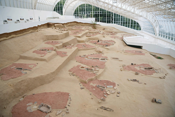 A village founded around 8,200 years ago on the banks of the Danube River in Serbia’s Iron Gates Gorge has puzzled archaeologists ever since it was excavated in the 1960s. Called Lepenski Vir, the community seemed to combine traits of local hunter-gatherer cultures of the Mesolithic period with traits of Neolithic farmers originating in Anatolia (modern-day Turkey) and Greece. Some discoveries made in the village, such as trapezoidal houses and fish-head figurines, were utterly unique to Lepenski Vir. Previous isotope analysis of skeletons uncovered at the site appeared to provide evidence that women from farming settlements to the south married into an established foraging community. This suggested that Lepenski Vir was a Mesolithic village whose inhabitants transitioned to an agricultural way of life.
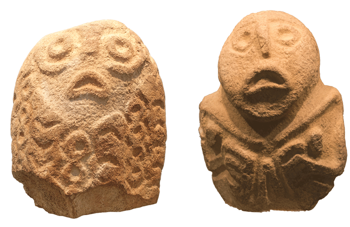 However, new research by a team including archaeologist Maxime Brami of Johannes Gutenberg University Mainz raises the possibility that the village was settled by Neolithic farmers who accepted foragers and some of their practices into their community. Recent DNA analysis of 34 skeletons uncovered at the site shows that men, women, and children with genetic profiles similar to those of Neolithic farmers from Anatolia were buried beneath homes at the site, while a few people whose DNA matches that of Mesolithic hunter-gatherers from Europe were buried on the periphery of the settlement. New analysis of isotope data previously gathered from the remains shows that those with Neolithic heritage ate fish along with cultivated foods, while the foragers at the site seem to have remained on a Mesolithic diet consisting mainly of fish. “What we think we see at Lepenski Vir is a settlement founded by farmers, who later adopted some foraging practices,” says Brami. “But foragers there did not become farmers.”
Storming the Castle
By ERIC A. POWELL
Tuesday, December 06, 2022
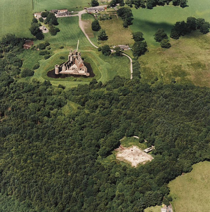 With a commanding view of southwestern Scotland’s Solway Firth, Caerlaverock Castle was the seat of the powerful Maxwell clan, which held the strategic coastal bastion during the late medieval Wars of Scottish Independence. The triangular fortress, which was besieged by English forces several times, was built starting in 1277. It was located around 600 feet uphill from an earlier moated fortification, known as Old Caerlaverock Castle, which was abandoned just 50 years after it was built. Recently, an interdisciplinary team led by University of Stirling environmental scientists Eileen Tisdall and Richard Tipping investigated Old Caerlaverock Castle and the landscape around it to explore why the fortification was occupied for such a short period. Building on earlier research at the site, they discovered that the moat of the old castle was filled with sediments deposited by multiple storms in the thirteenth century, which is known to have been a period of heightened storm activity.
By investigating and dating gravel ridges that were deposited just off the coast during these storms, the team has determined that storm surges of between 15 and 30 feet high flooded the old castle. “The irrepressible waves of these surges were like tsunamis,” says Tipping. “While they may not have wrecked the castle, psychologically the storms must have scared people rigid.” It’s also possible that the old, perpetually damp castle with its vulnerable moat simply didn’t match the Maxwells’ sense of their growing political importance. “Maybe they wanted more glamour,” says Tisdall, who notes that the later castle’s triangular design is unique in the United Kingdom. “It’s very much a statement castle.”
Advertisement
Page 1 of 2
Advertisement
IN THIS ISSUE
Advertisement

Recent Issues
-
 May/June 2024
-
 March/April 2024
-
 January/February 2024
-
 November/December 2023
-
 September/October 2023
-
 July/August 2023
-
 May/June 2023
-
 March/April 2023
-
 January/February 2023
-
 November/December 2022
-
 September/October 2022
-
 July/August 2022
-
 May/June 2022
-
 March/April 2022
-
 January/February 2022
-
 November/December 2021
-
 September/October 2021
-
 July/August 2021
-
 May/June 2021
-
 March/April 2021
-
 January/February 2021
-
 November/December 2020
-
 September/October 2020
-
 July/August 2020
-
 May/June 2020
-
 March/April 2020
-
 January/February 2020
-
 November/December 2019
-
 September/October 2019
-
 July/August 2019
-
 May/June 2019
-
 March/April 2019
-
 January/February 2019
-
 November/December 2018
-
 September/October 2018
-
 July/August 2018
-
 May/June 2018
-
 March/April 2018
-
 January/February 2018
-
 November/December 2017
-
 September/October 2017
-
 July/August 2017
-
 May/June 2017
-
 March/April 2017
-
 January/February 2017
-
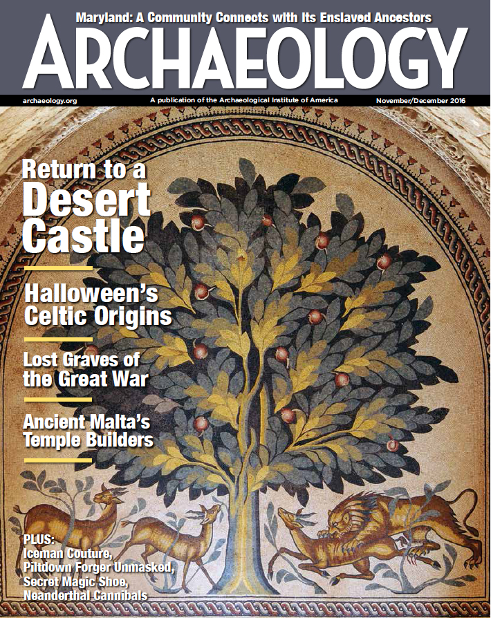 November/December 2016
-
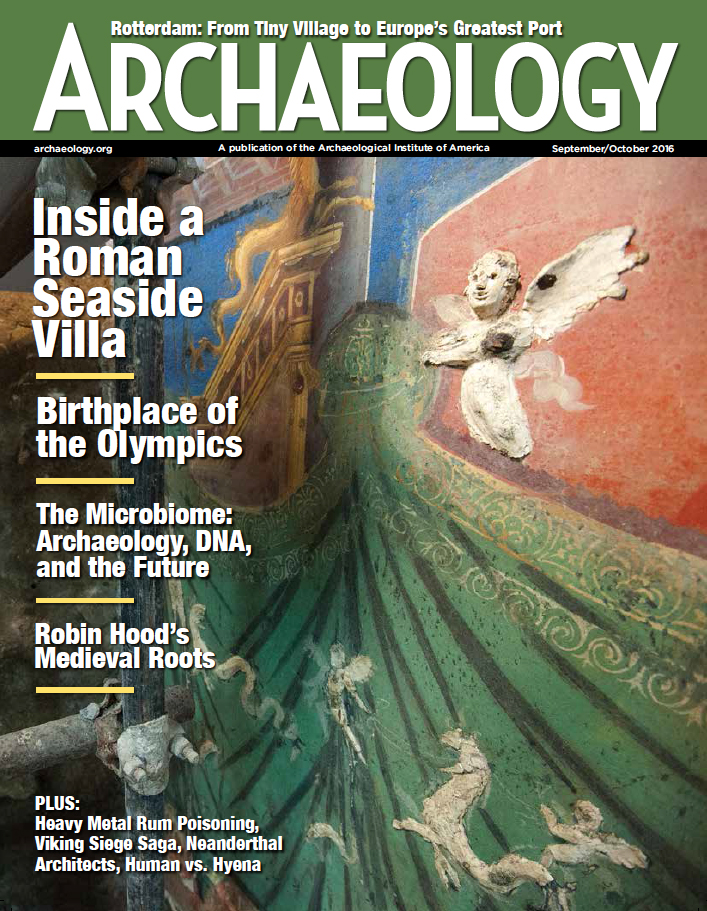 September/October 2016
-
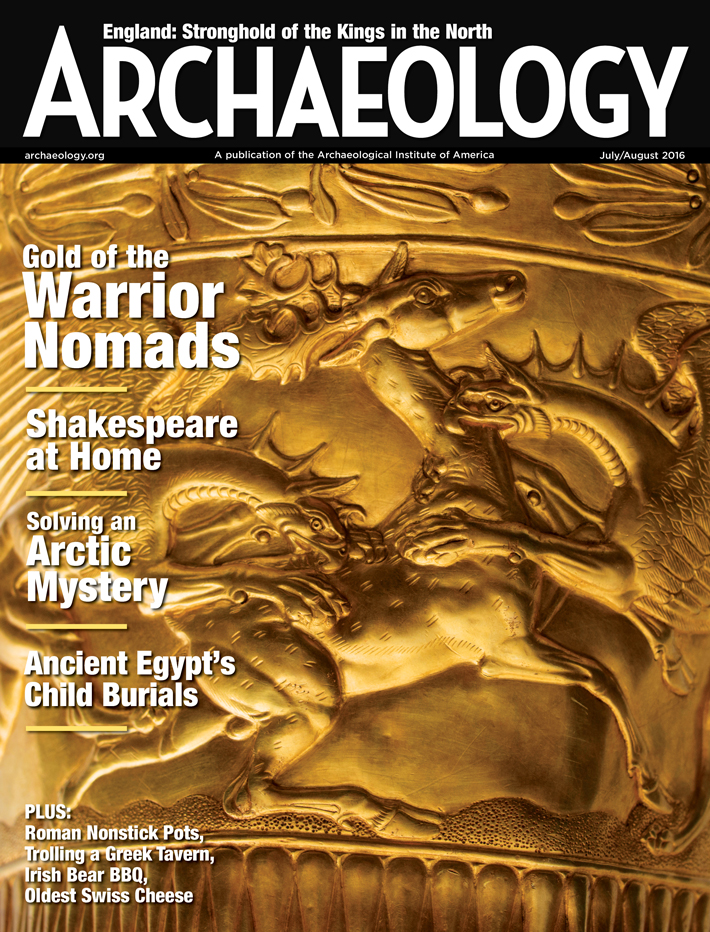 July/August 2016
-
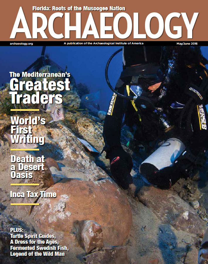 May/June 2016
-
 March/April 2016
-
 January/February 2016
-
 November/December 2015
-
 September/October 2015
-
 July/August 2015
-
 May/June 2015
-
 March/April 2015
-
 January/February 2015
-
 November/December 2014
-
 September/October 2014
-
 July/August 2014
-
 May/June 2014
-
 March/April 2014
-
 January/February 2014
-
 November/December 2013
-
 September/October 2013
-
 July/August 2013
-
 May/June 2013
-
 March/April 2013
-
 January/February 2013
-
 November/December 2012
-
 September/October 2012
-
 July/August 2012
-
 May/June 2012
-
 March/April 2012
-
 January/February 2012
-
 November/December 2011
-
 September/October 2011
-
 July/August 2011
-
 May/June 2011
-
 March/April 2011
-
 January/February 2011
Advertisement


